European dashboards and explorers#
Plenty of great tools for exploring climate, environmental, vulnerability and exposure data are already online and can be accessed openly. Here, we summarize some of these relavant dashboards and portals for exploring data relevant for conducting a Climate Risk Assessment.
Note
This list will be updated throughout the project. Send us a suggestion in an issue on GitHub!
IPCC Interactive Climate Atlas#
The Interactive Atlas (IA) in the Sixth Assessment Report (AR6) Working Group I (WGI) report enables detailed regional exploration of observed and projected climate data through interactive maps, time series, and other visual tools, focusing on key atmospheric and oceanic variables. It offers flexible temporal and regional analysis and incorporating both global and regional climate projections, as well as socio-economic factors, for comprehensive climate impact assessments.
C3S Interactive Climate Atlas#
Complementary to the IPCC Climate Atlas, Copernicus Climate Change service produced the C3S Interactive Climate Atlas, a web application that allows for flexible temporal and spatial exploration and analysis of recent past trends and projected future changes for a wide range of key climate variables from multiple datasets.
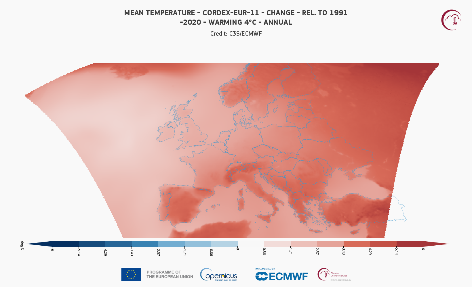
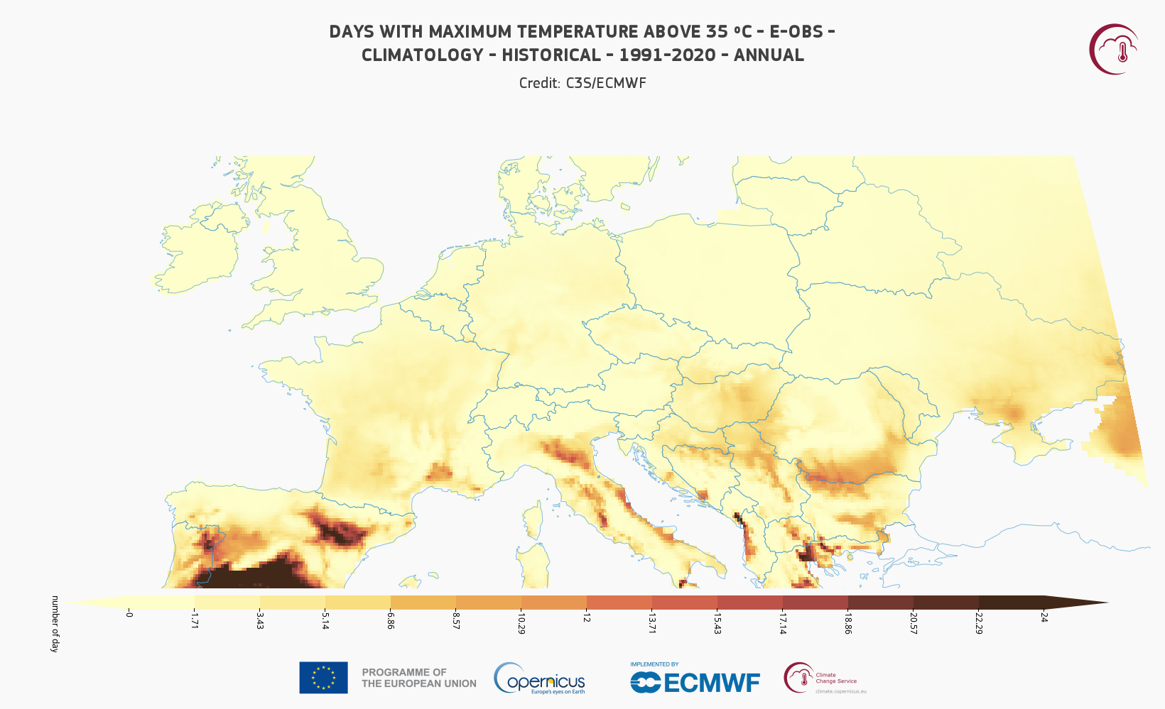
Using this application, it is possible to explore past and future climate for global and regional analysis, as well to download images ready for documents. More information can be found in the Climate Atlas announcement.
JRC dashboards#
The European Commission Disaster Risk Management Knowledge Centre (DRMKC) integrates existing scientific multi-disciplinary knowledge and co-develops innovative solutions for existing needs. Developed by Joint Research Centre (JRC), integral part of DRMKC is the Risk Data Hub, a multi-hazard geo-portal designed to bridge science and policy across different scales, facilitating collaboration between scientists and end-users. The Risk Data Hub Modules provide access to hazard, vulnerability and risk data needed for a Climate Risk Assessment.
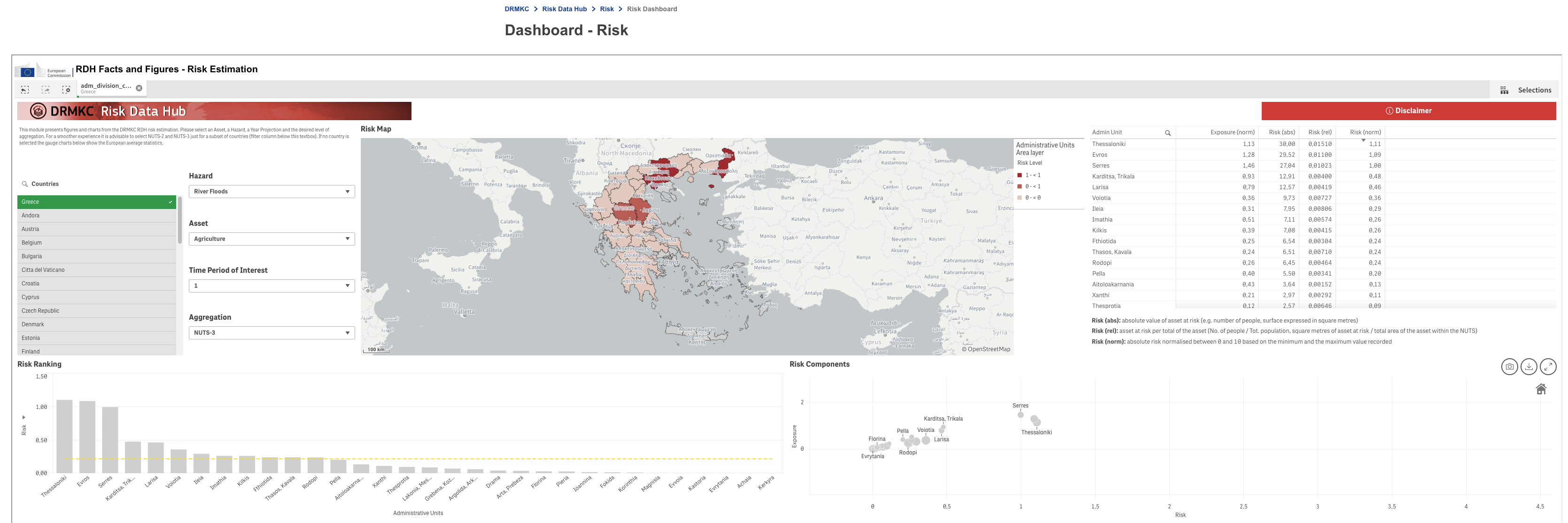
The Risk Module and Risk Dashboard can be found on the Risk Home web page.
The Vulnerability Module can be found on the Vulnerability Home web page.
IIASA Climate Solutions Explorer#
The Climate Solutions Explorer maps and presents information about mitigation pathways, avoided climate impacts, vulnerabilities and risks arising from development and climate change. All the maps and graphs are available for download as well as acompanying data. Users can explore interactive maps and reports for individual countries.
Watch the recording of the webinar explaining the Climate Solutions Explorer to learn more:
European Climate Data Explorer#
The European Climate Data Explorer (ECDE) allows for the exploration and analysis of recent past trends and projected future changes of key climate indicators. Further information can be found in the user guide and the data documentation of the ECDE.